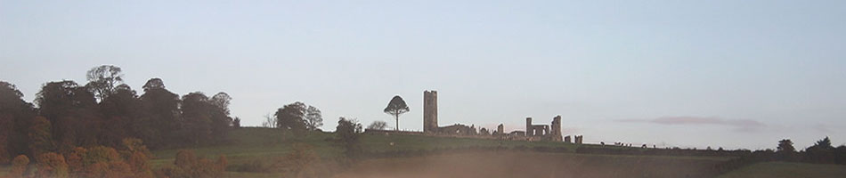
Free Tours of the Hill of Slane for Heritage Week 2014
There will be an action-packed week on the Hill of Slane during Heritage Week including daily free tours as well as a demonstration of the latest archaeological surveying technologies. The tours will cover the long history of the site from prehistory to the present, including the famous visit by St Patrick, with an emphasis on the physical remains and the visible archaeological monuments. Results from the ongoing archaeological survey work being conducted on the hill will be presented in context. For more information about Heritage Week events in Meath and around the country, please visit heritageweek.ie.
This year there has been an exciting new development – there is now a group of local volunteer guides who have come together to offer tours of the site. Heritage Week 2014 is to be the official launch of this new service and we hope that the scheme will develop over time.
In addition to the tours which will take place at 3pm on each day of Heritage Week (apart from Sunday 24th which is the Ladywell Fete at Slane Castle, another Heritage Week event), there will be a display of geophysical survey techniques on the site. If you have ever seen the Channel 4 programme Time Team, you will be familiar with the ‘geophys’ equipment they used to rapidly survey sites. Come along and have all your questions answered about these an other modern archaeological survey techniques! This is being kindly facilitated by Kevin Barton of Landscape and Geophysical Services who has been involved in the Hill of Slane Archaeological Project since its inception and Meath County Council Heritage Office. Further details here.
Tours will take about an hour, maybe more depending on the level of interest! Please dress for the weather, this is an open site. Also, please wear appropriate footwear.
The dates and times of the tours on the Hill of Slane are as follows:
- Saturday 23rd – meet in Hill of Slane car park at 3pm.
- Sunday 24th August – No tour. Ladywell Fete Slane Castle.
- Monday 25th August – meet in Hill of Slane car park at 3pm.
- Tuesday 26th August – meet in Hill of Slane car park at 3pm.
- Wednesday 27th August – meet in Hill of Slane car park at 3pm.
- Thursday 28th August – meet in Hill of Slane car park at 3pm.
- Friday 29th August – meet in Hill of Slane car park at 3pm.
- Saturday 30th August – meet in Hill of Slane car park at 2.30pm. Remote Sensing/geophysics demonstration.
- Sunday 31st August – meet in Hill of Slane car park at 3pm.

Kite aerial photography underway on the Hill of Slane during the ArcLand International Archaeological Field School in April 2012

Kite aerial photography; oblique photograph taken from the east showing St Patrick’s church and graveyard and the College/rectory which were scanned in the terrestrial laser scanning module. (photo: Asia Balcerzak/Michal Pisz)

Kite aerial photography; near vertical photograph of the multi-method geophysical survey area to east of the graveyard. The locations of the georeferencing control points are highlighted in white. (photo: Asia Balcerzak/Michal Pisz)
Report on the Hill of Slane Field School, Co. Meath, Ireland. 8th to 13th April 2012
AN INTRODUCTION TO MULTI-METHOD ARCHAEOLOGICAL SITE SURVEY: SURFACE COLLECTION AND REMOTE SENSING
by Kevin Barton and Conor Brady
This article first appeared on the ArchaeoLandscapes Europe website on Tuesday, 22 May 2012 11:04.
Introduction
In this article we report on the organisation, operation, ongoing work and preliminary results from surveys carried out during the Field School which was the first of its kind in Ireland. Subsequent articles will present the final results and discuss experiments in magnetic gradiometry field survey carried out during the School.
The Field School was composed of eighteen students from eleven countries including Ireland; Bolivia (1), Denmark(1), Estonia (2), Finland (1), Germany (1), Greece (1), Ireland (4), Latvia (1), Poland (3), Slovakia (2) and USA (1).
Field School practical work was based on the Hill of Slane where there is an ongoing archaeological research project – https://hillofslane.wordpress.com

Major features on the Hill of Slane (from the Hill of Slane Heritage Guide, Seaver & Brady, 2012)
Accommodation and a multi-purpose room used for lectures and data processing were provided at Slane Farm Hostel.
The intensive six day School was run for graduates from an archaeology or Earth sciences background. It provided an introduction to surface collection, low level aerial photography, upstanding building recording and a range of archaeological geophysical techniques.
The main objective was to provide an understanding of the principles of and hands-on experience of the field operation of the techniques. There was also basic instruction in data processing and interpretation.
An additional objective of the School was to provide and use open source software if this was possible. This would allow students to continue work on data collected after the School had finished.
The Field School was organised in four modules:
- Surface collection with reconnaissance geophysics
- Kite aerial photography
- Terrestrial laser scanning
- Multi-method geophysical survey
Over the duration of the Field School a partnership of six tutors and three students (who contributed as specialized part-time tutors) delivered field demonstrations with hands-on instruction and evening sessions on survey techniques, software and data processing.
Tutors were drawn from Landscape & Geophysical Services, Dundalk Institute of Technology, The Discovery Programme and the University of Warsaw. Kieran Campbell, Field Archaeologist, and the Irish Archaeology Field School provided field supervision and logistical support respectively.
Early arrivals on Easter Saturday 7th April were in time to take part in the first ever Flame of Slane festival. The festival was in commemoration of St. Patrick who in Early Christian times lit a Paschal fire reputedly challenging the precedence of a pagan fire ritual. The students reported that this festival was a very exciting way to start off the week!
Sunday 8th April was devoted to an introduction to the archaeological significance of the area with a morning visit to the nearby Brú na Bóinne World Heritage Site. This included a visit to the Brú na Bóinne Visitor Centre and guided tours of the major monuments of Newgrange Passage Tomb and the Knowth Tomb complex. The afternoon was spent on the Hill of Slane where the main elements of the site and the fieldwork areas were introduced.
Field School participants were presented with a copy of the recently published first Heritage Guide to the Hill of Slane which presents the archaeological and historical background and current research. The Heritage Guide was supported by ArchaeoLandscapes Europe with a contribution towards the production costs.
In the evening there were introductory lectures on the archaeology of the area and on geophysical field techniques. Each student received a Field School manual and assignment to one of four teams who worked together throughout the week.

Among the satellite tombs in the Knowth Tomb Complex. (photo: Ester Oras)
Surface collection with reconnaissance geophysics
Monday 9th April was the first fieldwork day with typical seasonal weather conditions – misty with intermittent rain showers and occasional sunshine. The day was devoted to surface collection combined with surveying and reconnaissance geophysical survey.
The fieldwork was targeted in a recently cultivated field on the southwest flank of the Hill. The field had not been cultivated for a number of years and no surface collection or other ground surveys had ever been carried out. The objectives were to investigate the archaeological potential of the field and assess the suitability of the techniques and methodologies used.
This fieldwork module provided the first opportunity for the students to work together in a team, to lay out a simple grid, to learn a field walking technique, to identify, mark and record potential targets and to survey reconnaissance transects using metal detecting and magnetic susceptibility equipment. No artefacts were removed from the field and no excavation was carried out on metal detector hits or magnetic susceptibility anomalies. Artefacts and metal detector hits were identified, their locations marked and recorded using a dGPS. Magnetic susceptibility measurements were carried out on a 5m paced grid and their locations also logged using a dGPS.

Surface collection area; field walking transect. (photo: Conor Brady)

Surface collection area; preliminary results from field walking transects.

Surface collection area; recorded metal detection transect. (photo Conor Brady)
As the day progressed results from the surface collection surveys indicated finds of flint (some burnt), chert, ceramics, stone, glass and metal. Metal detection hits appeared not to correlate with surface collection locations and there were indications of modern metal debris in the field.

Surface collection area; planning a dGPS and magnetic susceptibility survey strategy (photo: Conor Brady)
.
.
.
.
.
.
.
.
.
.
.
.
.
.
.
Magnetic susceptibility results showed some zones of enhancement, particularly over a zone of dark soil (with possible fire cracked stone) identified in the surface collection survey. The preliminary results were discussed during the evening when an early aerial photograph was reviewed which indicated a number of possible features in the field. The finding of flint and chert was significant as this is the first material evidence for possible pre-historic activity associated with the Hill.

Evening session; data processing. (photo: Conor Brady)
Tuesday 10th April was an action packed day with trials of the kite for low level aerial photography, the arrival of the Discovery Programme to start their module on terrestrial laser scanning and the start of the multi-method geophysical survey on a selected target on the Hill.
The logistics of providing hands-on experience of the techniques available to members of each team were quite complex and a rotation was started whereby each team spent half a day collecting data with each set of equipment.
The evening session was devoted to a presentation by The Discovery Programme on laser scanning techniques and an indoor demonstration of scanning medieval tiles.
Kite aerial photography
Kite Aerial Photography (KAP) was contributed by students from the University of Warsaw. Wind conditions on the Hill were very variable and the wind direction and speed were tested in advance of deploying the kite alone and the kite with the camera platform.
Due to wind variability, as the week progressed, it became apparent that the KAP module could not be easily timetabled in the rotation of the teams. At times when a team had completed data collection or there was a problem with equipment, the opportunity was taken to reallocate the team to ongoing test flights and photography in the KAP module.
This change to the programme was fortuitous as unfortunately later in the week freak wind conditions caused the kite tether to fail resulting in the platform with camera crashing to the ground. The camera and platform were damaged and could not be repaired for further use during the School.

Kite aerial photography; camera control unit and camera platform (photo: Michal Pisz)

Kite aerial photography; winch and kite cable. (photo: Asia Balcerzak)

Kite aerial photography; kite and camera platform. (photo: Asia Balcerzak)
Before the KAP equipment was damaged, some excellent oblique aerial photographs were obtained including the surface collection, St Patrick’s church and graveyard, the College and multi-method geophysical survey areas. For the latter area, ground control markers were positioned in the survey area so the photograph could be later georeferenced once the marker locations had been captured in Irish National Grid with a dGPS.

Kite aerial photography; oblique photograph taken from the northeast showing the part of the graveyard and the cultivated field to the southwest which was surveyed in the surface collection module. (photo: Asia Balcerzak/Michal Pisz)
Kite aerial photography; oblique photograph taken from the east showing St Patrick’s church and graveyard and the College/rectory which were scanned in the terrestrial laser scanning module. (photo: Asia Balcerzak/Michal Pisz)
Kite aerial photography; near vertical photograph of the multi-method geophysical survey area to east of the graveyard. The locations of the georeferencing control points are highlighted in white. (photo: Asia Balcerzak/Michal Pisz)
In addition to the KAP an opportunity was taken to experiment with the creation of an interactive 3-D model of a carved stone head which was embedded in the graveyard wall. A series of 45 overlapping photographs were taken which were later processed in an evening session using open source software to produce a 3-D model.

3-D photography; an image from the series of photographs used to make an interactive 3-D model of the carved stone head. (photo: Asia Balcerzak)
Terrestrial laser scanning
This module utilized three types of terrestrial scanner each operating using a different scanning principle or mode. The three scanners were used to demonstrate the principles and practice of laser scanning. Laser scanning was carried out in the following modes:
- time of flight
- triangulation
- phase comparison
The laser scanning fieldwork module was delivered in three sections:
In the first section, a time of flight instrument which was set up in the graveyard and used to demonstrate basic scanning principles with some hands-on experience. Demonstration scans were made of a small area of St Patrick’s church.

Terrestrial laser scanning; setting up a scan of St Patrick’s medieval church.(photo: Anthony Corns)
The instrument deployed in the second section was a triangulation-based artefact scanner used to scan the carved stone head embedded in the wall of the graveyard. For quality control and demonstration purposes, data were downloaded and partially processed on a field laptop computer.

Terrestrial laser scanning; scanning the carved stone head in the graveyard wall. (photo: Conor Brady)
.
.
.
.
.
.
.
.
.
.
.
.
.
.
.
The third section of the module was carried out in and around the College or rectory building. Control points with associated targets were set up in strategic locations using a dGPS. These points allowed scanned coverage of most of the external fabric of the building and selected interior areas. Here data were captured using a phase comparison instrument.

Configuring a scan of the internal walls of the College/rectory. (photo: Asia Balcerzak)
Individual scans of the College were processed and compiled to make a series of colour and greyscale images and animations.

Terrestrial laser scanning; a colour compilation of the scan of the College from the east showing the gatehouse, College wall and the nearby St Patrick’s church tower. (Image: The Discovery Programme)
Multi-method geophysical survey
This module involved fieldwork immediately to the east of the graveyard. The twin objectives here were to investigate possible archaeological features noted or monitored in a narrow trench and to provide the opportunity for hands-on experience of data collection using a range of geophysical instruments and techniques. The 30cm wide and up to 60cm deep trench had been dug in 1997 to lay a power cable for floodlighting St Patrick’s church and the College.

View looking east from the tower of St Patrick’s church showing the line of the back-filled trench. (photo: Kieran Campbell)
In surveying this area, there were two main issues to be considered in evaluating the magnetic responses measured by certain geophysical instruments. Firstly, the relatively sparse rock outcrop on the Hill has been geologically mapped as tuff, stratified volcanic ash, which could be magnetic. Secondly, the survey area is open to the general public and there was likely to be contamination of the topsoil with ferrous litter.
The question of whether the responses from magnetic survey methods would be influenced by possibly naturally magnetic geology and/or metal debris needed to be investigated as this could influence the archaeological interpretation of the data.
The geophysical surveys were carried out on a series of 20m x 20m grids centred on the estimated line of the trench and extending 80m along it. Survey lines were orientated perpendicular to the direction of the trench. Each team had the opportunity to use each instrument or technique for half day on at least two allocated 20m x 20m grids.
Magnetic susceptibility
Topsoil magnetic susceptibility surveys were carried out with a susceptibility meter and a 0.18m field loop. The surveys, on a 2m x 2m grid, were to assess the magnetic properties of the topsoil and to prospect for zones of enhancement associated with possible archaeological features recognised in the trench. The susceptibility measurements and their locations were logged using a dGPS.

Magnetic susceptibility survey in the vicinity of the trench. (photo: Asia Balcerzak)

Magnetic susceptibility; contoured and coloured georeferenced map of part of the survey area showing zones of enhancement.
Magnetic gradiometry
Magnetic gradiometry surveys were carried out using single and twin fluxgate gradiometer instruments. The objective was to investigate cut features recorded in the trench to see if they extended away from the trench. In addition each student had the opportunity to experiment in using a number of sampling densities and acquisition modes. The results from these experiments will be the subject of a later article.

Magnetic gradiometry; “am I non-magnetic?” (photo: Asia Balcerzak)

Magnetic gradiometry; configuring a single gradiometer with 1m sensor spacing. (photo: Michal Pisz)

Magnetic gradiometry; greyscale image of part of the survey area showing a weak response from the west – east trench intersected by a possible linear archaeological feature. Sampling interval 1m x 0.25m.
Earth resistance
Earth resistance surveys were carried out using a twin probe array on a 0.5m x 0.5m sampling interval. The objective was to see if the trench and large scale cut features observed in it had a resistance response and, if so, did the features extend away from it.

Earth resistance; 0.5m twin-probe array survey over the trench. (photo: Jaroslava Panisova)

Earth resistance; greyscale image of part of the survey area showing a weak low resistance response from the west – east trench and a parallel previously unknown feature lying to the south.
Earth resistance; greyscale image of part of the survey area showing a weak low resistance response from the west – east trench and a parallel previously unknown feature lying to the south.
Electrical resistivity tomography
A number of short electrical resistivity tomography (ERT) transects were run perpendicular to the trench using a Wenner array configured in multiples of an initial 0.5m electrode spacing. The objectives were to investigate if the trench could be imaged and also to assess the geological structure in the area. ERT surveys were carried out in manual and semi-automatic modes to illustrate the principle of sequential expansion of electrode spacings in order to construct a resistivity pseudosection.

Electrical Resistivity Tomography; “which electrode do we move next?” (photo: Jaroslava Panisova)

Electrical resistivity tomography; south to north modelled pseudosection. The response from the trench can be seen just after 10m along the section.
Ground penetrating radar
A ground penetrating radar survey was carried out on individual 20m x 20m grids with a 0.5m line spacing and 0.025m sampling interval. The 400 MHz centre frequency transmitted signal was initiated with a survey wheel. The objectives were to produce high spatial resolution sections and horizontal slices to investigate the extent of small scale features recognised in the trench and also the geological structure in the area.

Ground penetrating radar; control/data logger console, control/data cable and transmitting/receiving antenna mounted on a sled. (photo: Séamus Ó Murchú)

Ground penetrating radar; a selected horizontal time slice of two 20m x 20m grids showing the west – east trench with intersecting features.
Additional fieldwork
Over the course of the five days in which modules 1, 2, 3 and 4 were delivered there were some weather delays, equipment problems and failures and operator errors which had to be factored into the programme. Additional time had been built into the timetable that allowed for alternative work to be carried out. This allowed follow-up magnetic susceptibility survey of the area of dark soil discovered during the surface collection module, additional dGPS mapping of finds and metal detector hits in the surface collection area, additional GPR survey inside the College and use of the dumpy or engineer’s level for those who needed an introduction to, or refresher in, the use of this instrument.
Outreach
Public access to the Field School was facilitated by an ‘open afternoon’ which was publicized locally. Over 50 visitors came to see the work of the School and the monuments on the Hill. Valuable contacts were made with many discussions about the history and archaeology of the Hill and surrounding area. Important oral history was obtained which will be helpful in the ongoing research project.
On the last day of fieldwork RTE, the national television network, did a piece on the Field School and the positive benefit to the Slane community. The piece opened with photographs taken during the KAP module and was broadcast in the main news bulletins at 18.00 and 21.00.
http://www.rte.ie/news/av/2012/0413/media3256784.html#&search=Hill%20of%20SLane

RTE News filming magnetic gradiometry tuition. (photo: Conor Brady)
.
.
.
.
.
.
.
.
.
.
.
.
.
.
.
Conclusion of the Field School and future work
The final evening session involved a review of the work of the Field School and discussion on completion of data processing, interpretation and reporting aspects of the results obtained. Given the volume and variety of data collected and the time available it was not possible to complete all the work and it was suggested that this could be remedied using the internet to conduct a number of seminars.
A system was set up to share an online computer folder amongst the tutors and students. The folder was populated with open source software, guidelines on use of the software and the data collected during the field school.

Internet seminar in progress. (photo: Colin Barton)
There were four 1 hour seminars in the series. They involved revision on data processing carried out during the Field School and tuition on software, data and interpretation not dealt with during the School. Two final seminars will be carried out in autumn 2012 to integrate, present and interpret the data collected during the Field School with additional data subsequently collected.
Discussion
The students in their groups and as a whole worked and socialized well together with much good humour and cooperation. Each student came with their own reasons and needs in participating in the School. These included; a first experience in using some or all of the techniques, finding out how the techniques could be incorporated in an archaeological research design, needing information on processing and interpreting remote sensing data etc.
From comments and discussions during the Field School and subsequent reports sent to ArcLand, the School can be considered to have been an overall success. The students found participation in the Field School worthwhile and learnt new skills and ideas in the application of field survey and remote sensing techniques.
From the perspective of the Hill of Slane Archaeological Project, the results from the surface collection surveys show the area close to the hilltop to be archaeologically and geophysically prospective. In particular there is material evidence for possible pre-historic activity. Kite aerial photography, used for the first time on the Hill, has shown its possibilities in effectively monitoring the surrounding fields as and when they are cultivated. The terrestrial laser scans of the College will be completed to provide a detailed record of the structure and will be used in further research. The multi-method geophysical survey of a hitherto unsurveyed area east of graveyard has shown that features monitored in the narrow trench extend away from it and some are likely to be archaeological in nature. From the limited area surveyed there appears to be an enhanced background magnetic response from the bedrock and/or soils. The response appears relatively uniform with no large scale or rapidly changing variation. The area therefore is likely to be prospective using magnetic methods with special attention being paid to features that may be due to geological influences.
From a local community perspective the Field School helped to draw local, national and international attention to the Hill. The open afternoon for the public drew over 50 visitors to see the work of the Field School and in some cases visit the Hill for the first time. The RTE News item provided national and international attention by the broadcast and internet respectively. The students from 11 countries hopefully took away good memories of the Hill and surrounding area. The work of the Field School and publicity will help in the development of interpretation, signage and walks as part of local tourism initiatives.
Inevitably an introductory course with a broad range of topics by its very nature cannot fully cover all aspects in great detail and in particular data processing and interpretation where time and experience are important factors. With the range of interests of the students we didn’t, and perhaps couldn’t, get the balance between basic principles, hands-on experience, data processing and interpretation 100% right. The use of open source software and internet seminars has helped to bridge some gaps. We will do better next time!
Acknowledgements
Slane Farm Hostel provided excellent facilities and helped in many ways to make the Field School a success. Thanks to the Irish Archaeology Field School who very kindly lent us their minibus to ferry the participants between the hostel and the Hill each morning and evening. We are also very grateful for the support we received from ArchaeoLandscapes Europe who provided grant assistance for 8 participants to travel to Ireland to take part in the Field School. The publicity we received through the ArcLand website was also a major factor in the provision of the Field School. We are also grateful to the local landowners who granted us access to their lands for our activities and also to the Office of Public Works who own the publicly accessible part of the Hill. Brú na Bóinne Visitor Centre kindly facilitated the visit to the Centre, Newgrange Passage Tomb and the Knowth Tomb Complex. Finally, thank you to the students for their humour, energy and enthusiasm in making the Field School a success.

Home time! (photo: Conor Brady)

You must be logged in to post a comment.